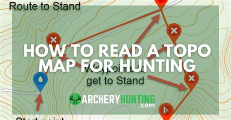
How To Read A Topographic Map For Deer Hunting
Ronan Farrow
Apr 02, 2025 · 3 min read

Table of Contents
How to Read a Topographic Map for Deer Hunting
Deer hunting success often hinges on understanding the terrain. Knowing where deer are likely to be is half the battle, and topographic maps are your secret weapon. This guide will walk you through interpreting topographic maps specifically for maximizing your deer hunting opportunities.
Understanding the Basics of Topographic Maps
Topographic maps are not just pictures; they're three-dimensional representations of the land's surface, showing elevation changes, features, and more. Mastering them translates to better hunting strategy.
Key Map Elements:
- Contour Lines: These are the most crucial element. Each line represents a constant elevation. Closely spaced lines indicate steep slopes; widely spaced lines show gentler terrain.
- Elevation: The map's legend will specify the interval between contour lines (e.g., 10 feet, 20 feet). This helps you calculate the height difference between points.
- Index Contours: Thicker lines, usually labeled with elevation, help you easily read the elevation at different points on the map.
- Relief Shading: Some maps use shading to show the shape of the land, making slopes and valleys more apparent.
- Symbols: These represent various features like roads, trails, water bodies (rivers, streams, lakes, ponds), and vegetation. Understanding these symbols is critical for identifying deer-favored areas.
Identifying Prime Deer Hunting Locations on a Topographic Map
Deer, like all wildlife, seek out specific terrain features for survival and comfort. By understanding these preferences and using a topographic map, you can significantly improve your chances of success.
Look for These Key Features:
- South-Facing Slopes: These slopes receive more sunlight and tend to have better vegetation growth, attracting deer.
- Water Sources: Deer need water, so locate springs, streams, and rivers. Areas near these sources are prime locations.
- Edges and Transitions: Deer prefer areas where different habitat types meet (e.g., the edge of a forest and a field). This provides them with food and cover. These are often denoted by changes in contour line spacing and vegetation symbols on the map.
- Funnels: These are narrow passages where deer are forced to travel, such as saddles between hills or valleys. These are excellent ambush locations.
- Thermal Cover: During harsh weather, deer seek sheltered areas like dense woods on north-facing slopes, ravines, and thickets. Note these areas for hunting during inclement conditions.
- Feeding Areas: Identify open fields, agricultural lands, and clearings near forested areas where deer feed. These areas are often at lower elevations.
Utilizing the Map During Your Hunt
A topographic map is not just a pre-hunt planning tool; it's a crucial in-field resource.
Practical Applications:
- Navigation: Use the map to track your location and plan your routes carefully. Avoid alerting deer by staying on existing trails whenever possible.
- Wind Direction: Consider prevailing winds and plan your approach to hunt downwind of deer to minimize your scent.
- Concealment and Cover: Use the map to identify locations with sufficient cover to conceal yourself from deer.
Advanced Strategies for Topographic Map Use
For more advanced hunters, further analysis of topographic maps can enhance hunting strategies.
Advanced Techniques:
- Analyzing Terrain Complexity: Look at the density and variation in contour lines to understand how difficult the terrain is to navigate, both for you and for the deer.
- Identifying Animal Trails: Often, deer create well-worn paths. These are sometimes indicated on detailed maps or can be inferred from subtle changes in vegetation or ground cover.
- Combining with Other Data: Integrating topographic map information with satellite imagery, aerial photos, or trail camera data can paint a comprehensive picture of deer movement patterns.
By diligently studying topographic maps and understanding deer behavior, you can significantly enhance your hunting success. Remember that patience, practice, and respect for the environment are crucial aspects of responsible hunting.
Featured Posts
Also read the following articles
| Article Title | Date |
|---|---|
| How To Remove Ecm Connector | Apr 02, 2025 |
| How To Transport Outboard Motor | Apr 02, 2025 |
| How To Start A Gun Store | Apr 02, 2025 |
| How To Remove A Treble Hook From A Fish | Apr 02, 2025 |
| How To Sell A Rabbit | Apr 02, 2025 |
Latest Posts
Thank you for visiting our website which covers about How To Read A Topographic Map For Deer Hunting . We hope the information provided has been useful to you. Feel free to contact us if you have any questions or need further assistance. See you next time and don't miss to bookmark.
